| CalPhotos |
Number of matches: 3300

near Ebbett's Pass, Toiyabe National Forest (California) ID: 1111 1111 2222 0126 [detail] © 2001 Joyce Gross |
near Ebbett's Pass, Toiyabe National Forest (California) ID: 1111 1111 2222 0125 [detail] © 2001 Joyce Gross |
Ringwood Preserve, Freeville, Tompkins County (New York) ID: 1111 1111 2222 0102 [detail] © 2001 Joyce Gross |
Ringwood Preserve, Freeville, Tompkins County (New York) ID: 1111 1111 2222 0103 [detail] © 2001 Joyce Gross |

Highland Lakes, Stanislaus National Forest (California) ID: 1111 1111 2222 0127 [detail] © 2001 Joyce Gross |
Salton Sea (California) ID: 1111 1111 2222 0563 [detail] © 2005 Joyce Gross |
Mitchell Canyon, Mt Diablo State Park (California) ID: 1111 1111 2222 0564 [detail] © 2005 Joyce Gross |

Afton Canyon (California) ID: 1111 1111 2222 0565 [detail] © 2005 Joyce Gross |
Lower Calf Creek Falls, Grand Staircase - Escalante National Monument, Garfield County (Utah) ID: 1111 1111 2222 0569 [detail] © 2005 Joyce Gross |
Kelso Dunes, Mojave National Preserve (California) ID: 1111 1111 2222 2082 [detail] © 2010 Joyce Gross |

Kelso Dunes, Mojave National Preserve (California) ID: 1111 1111 2222 2083 [detail] © 2010 Joyce Gross |

Short Canyon, Owen's Peak watershed, Sierra Nevada Mountains (California) ID: 1111 1111 2222 2084 [detail] © 2010 Joyce Gross |
Short Canyon, Owen's Peak watershed, Sierra Nevada Mountains (California) ID: 1111 1111 2222 2085 [detail] © 2010 Joyce Gross |
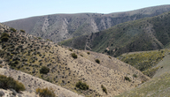
Temblor Range, from Hurricane/Crocker Springs Rd near McKittrick (California) ID: 1111 1111 2222 2504 [detail] © 2013 Joyce Gross |
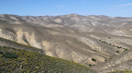
Temblor Range, from Hurricane/Crocker Springs Rd near McKittrick (California) ID: 1111 1111 2222 2505 [detail] © 2013 Joyce Gross |
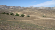
Temblor Range, from Hurricane/Crocker Springs Rd near McKittrick (California) ID: 1111 1111 2222 2506 [detail] © 2013 Joyce Gross |

Base of Temblor Range near mouth of Sandiego Creek. Taken from Hwy 58. (California) ID: 1111 1111 2222 2507 [detail] © 2013 Joyce Gross |
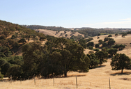
.7 miles south of Drytown along Hwy 49 (California) ID: 1111 1111 2222 2617 [detail] 2013 Joyce Gross |

Walker Pass Campground, Walker Pass (California) ID: 1111 1111 2222 2618 [detail] 2014 Joyce Gross |
along Sierra Way, 7.7 km south of Kernville (California) ID: 1111 1111 2222 2619 [detail] 2014 Joyce Gross |

Looking west from Sierra Way, south of Kernville. (California) ID: 1111 1111 2222 2622 [detail] 2014 Joyce Gross |
Kennedy Meadow Rd, just south of Chimney Basin Rd. (California) ID: 1111 1111 2222 2623 [detail] 2014 Joyce Gross |
Looking north across Sacatar Valley. (California) ID: 1111 1111 2222 2621 [detail] 2014 Joyce Gross |

South face of Pilot Knob, Sequoia National Forest. (California) ID: 1111 1111 2222 2620 [detail] 2014 Joyce Gross |
Using these photos: A variety of organizations and individuals have contributed photographs to CalPhotos. Please follow the usage guidelines provided with each image. Use and copyright information, as well as other details about the photo such as the date and the location, are available by clicking on the [detail] link under the thumbnail. See also: Using the Photos in CalPhotos.