| CalPhotos |
Number of matches: 37
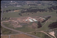
Dairy on Petaluma Hill Road, Santa Rosa (located on tributary to the Laguna de Santa Rosa), Bay Area Delta Bioregion (California) ID: 6250 3041 2844 0033 [detail] © North Coast Regional Water Control Board |

Geothermal Unit at the Geysers, Bay Area Delta Bioregion (California) ID: 6250 3041 2844 0009 [detail] © North Coast Regional Water Control Board |

Russian River near Asti, Bay Area Delta Bioregion (California) ID: 6250 3041 2844 0010 [detail] © North Coast Regional Water Control Board |

Russian River at Fitch Mountain looking west to Healdsburg, Bay Area Delta Bioregion (California) ID: 6250 3041 2844 0016 [detail] © North Coast Regional Water Control Board |
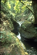
Santa Rosa Creek upstream of Santa Rosa, exact location unknown, Bay Area Delta Bioregion (California) ID: 6250 3041 2844 0036 [detail] © North Coast Regional Water Control Board |
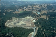
Closed landfill in Healdsburg, Bay Area Delta Bioregion (California) ID: 6250 3041 2844 0014 [detail] © North Coast Regional Water Control Board |

Russian River near Asti showing a hop field and wastewater treatment ponds, Bay Area Delta Bioregion (California) ID: 6250 3041 2844 0011 [detail] © North Coast Regional Water Control Board |
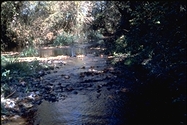
Mark West Creek at Old Redwood Highway, Santa Rosa, Bay Area Delta Bioregion (California) ID: 6250 3041 2844 0034 [detail] © North Coast Regional Water Control Board |

Mark West Creek/Laguna at Trenton-Healdsburg Road, Bay Area Delta Bioregion (California) ID: 6250 3041 2844 0035 [detail] © North Coast Regional Water Control Board |

Potter Valley on the East Fork of the Russian River (Potter Valley powerhouse/water diversion tunnel, at Van Arsdale Dam on the (California) ID: 6250 3041 2844 0003 [detail] © North Coast Regional Water Control Board |

Lumbermill at Calpella on the West Fork of the Russian River, Klamath North Coast Bioregion (California) ID: 6250 3041 2844 0002 [detail] © North Coast Regional Water Control Board |
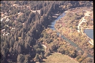
Confluence of Mark West Creek with the Russian River (community of Mirabel Park at upper left), Bay Area Delta Bioregion (California) ID: 6250 3041 2844 0023 [detail] © North Coast Regional Water Control Board |

Redwood Valley on the West Fork of the Russian River, Klamath North Coast Bioregion (California) ID: 6250 3041 2844 0001 [detail] © North Coast Regional Water Control Board |
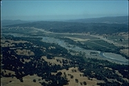
Russian River near Geyserville, Bay Area Delta Bioregion (California) ID: 6250 3041 2844 0012 [detail] © North Coast Regional Water Control Board |

Russian River at Alexander Valley Campground, Bay Area Delta Bioregion (California) ID: 6250 3041 2844 0013 [detail] © North Coast Regional Water Control Board |
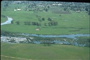
Laguna de Santa Rosa aerial, Bay Area Delta Bioregion (California) ID: 6250 3041 2844 0030 [detail] © North Coast Regional Water Control Board |

Russian River at Johnson's Beach from Highway 116 Bridge, Bay Area Delta Bioregion (California) ID: 6250 3041 2844 0026 [detail] © North Coast Regional Water Control Board |
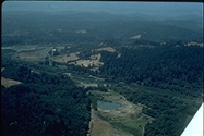
Russian River near Wohler Bridge (gravel extraction pond at center of photo), Bay Area Delta Bioregion (California) ID: 6250 3041 2844 0021 [detail] © North Coast Regional Water Control Board |

Russian River at Fitch Mountain (Del Rio Woods Beach), Healdsburg, Bay Area Delta Bioregion (California) ID: 6250 3041 2844 0015 [detail] © North Coast Regional Water Control Board |
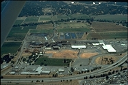
Masonite wood processing facility w. associated wastewater treatment ponds, Klamath North Coast Bioregion (California) ID: 6250 3041 2844 0006 [detail] © North Coast Regional Water Control Board |

Russian River at Healdsburg Wastewater Treatment Plant and Syar Pond looking north easterly, river flows from upper left of phot (California) ID: 6250 3041 2844 0020 [detail] © North Coast Regional Water Control Board |

East Fork of the Russian River entering Lake Mendocino, Klamath North Coast Bioregion (California) ID: 6250 3041 2844 0004 [detail] © North Coast Regional Water Control Board |
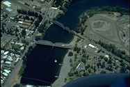
Healdsburg Memorial Beach, Bay Area Delta Bioregion (California) ID: 6250 3041 2844 0017 [detail] © North Coast Regional Water Control Board |
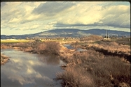
Laguna de Santa Rosa looking east from Stony Point Road, Rohnert Park, Bay Area Delta Bioregion (California) ID: 6250 3041 2844 0029 [detail] © North Coast Regional Water Control Board |
Using these photos: A variety of organizations and individuals have contributed photographs to CalPhotos. Please follow the usage guidelines provided with each image. Use and copyright information, as well as other details about the photo such as the date and the location, are available by clicking on the [detail] link under the thumbnail. See also: Using the Photos in CalPhotos.