CalPhotos    Photo Database

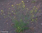
Diplotaxis tenuifolia; Ruculeta   

Contributors      Log In  
 

click photo for larger file
Diplotaxis tenuifolia
Ruculeta
Photographer: Richard D. Sage

ID: 0000 0000 0420 0725 (2020-04-09)

Copyright © 2020 Richard Sage

Related images:

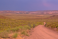
habitat:
related image related image

 
INFORMATION PROVIDED WITH THE PHOTO
  • date of photo  Jan 2, 2020
  • latitude -40.94901   longitude -70.66594     View on Google Maps.
  • location   in Mulinum/Nassauvia steppe vegetation (3.64 km W, 8.20 km N Pilcaniyeu Viejo), 950m elev. (Pilcaniyeu, Río Negro, Argentina)
  • family Brasicaceae
  • plant community   edge of road in Patagonian steppe
  • species associated with this habitat: Mulinum spinosum    Nassauvia axillaris    Tetraglochin alatum    Triptilion achilleae    Perezia recurvata    Diplotaxis tenuifolia    Acaena splendens    Acaena caespitosa    Boopis gracilis    Adesmia volckmannii    Rodophiala mendocina    Loasa bergii    Hypochaeris incana  
  • keywords: Patagonia, Steppe habitat
  • camera   Nikon D50, 50 mm lens
  • photo category: Plant - annual/perennial

  • MORE INFORMATION ABOUT THIS PLANT
  • common names   Ruculeta (photographer)
  • View all photos in CalPhotos of Diplotaxis tenuifolia
  • Check Google Images for Diplotaxis tenuifolia


  • The photographer's identification Diplotaxis tenuifolia has not been reviewed. Click here to review or comment on the identification.

     
    Using this photo   The thumbnail photo (128x192 pixels) on this page may be freely used for personal or academic purposes without prior permission under the Fair Use provisions of US copyright law as long as the photo is clearly credited with © 2020 Richard Sage. For other uses, or if you have questions, contact Richard D. Sage rdsage1943_NO_SPAM@gmail.com. (Remove "_NO_SPAM" from this email address before sending an email.)


    Copyright © 1995-2023 UC Regents. All rights reserved.

    CalPhotos is a project of BNHM     University of California, Berkeley