|
|
click photo for larger file
high resolution: ZOOM browser
view full size

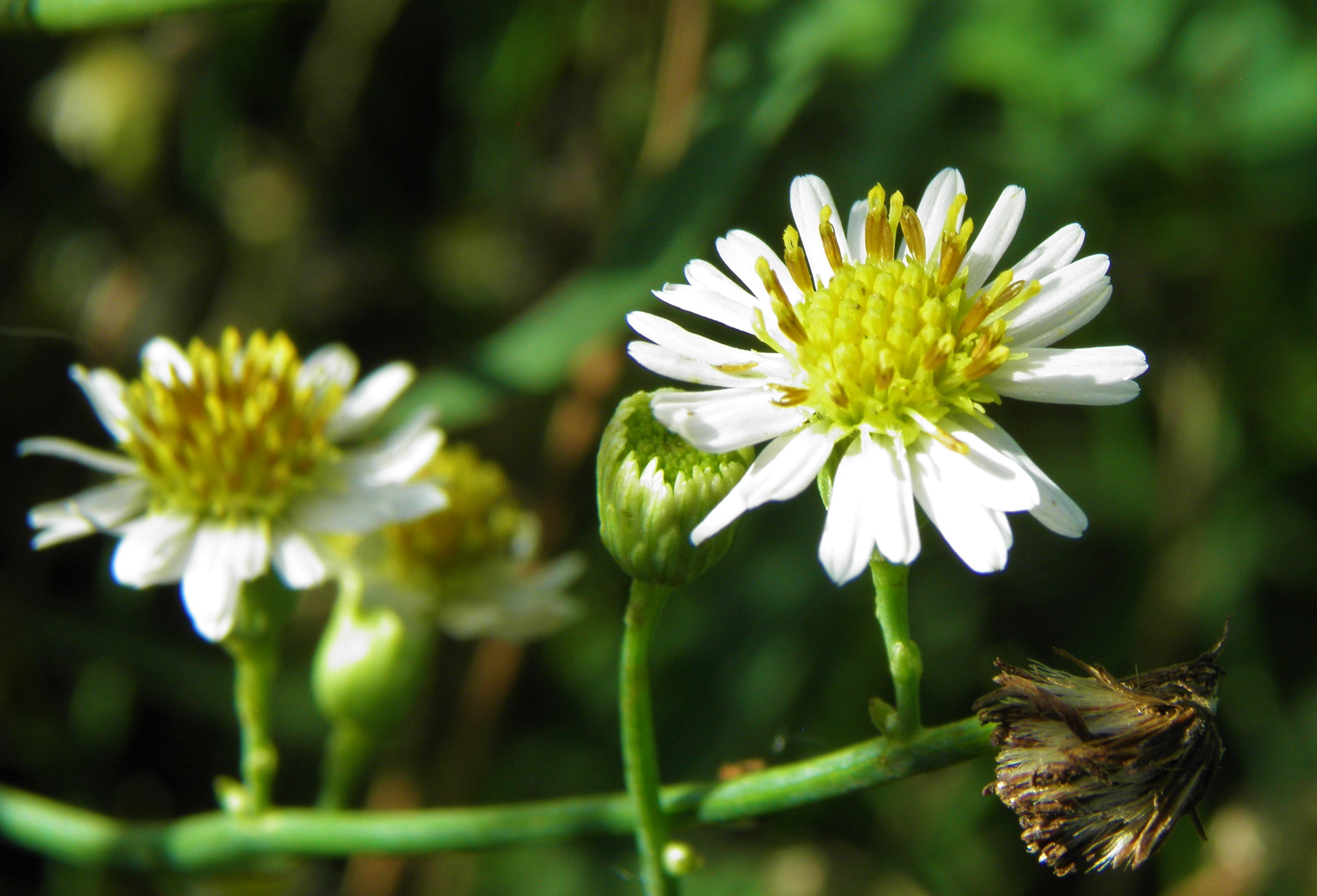
Chloracantha spinosa
Mexican Devilweed
|
Photographer: E. Wynn Anderson
ID: 0000 0000 1218 3497 (2018-12-29)Copyright © 2018 Wynn Anderson
|
|
INFORMATION PROVIDED WITH THE PHOTO
|
date of photo Sep 11, 2016
latitude 32.65200 longitude 107.11290
View on Google Maps.
location
State Highway NM 185, mile marker 33, 2.4 miles north of NM 140, 1.2 miles southeast of Rodney, 2.3 miles southeast of NM 154 in Hatch (Dona Ana County, New Mexico, US)family
Asteraceae
plant community Rio Grande riparian corridor at 4062' (1239m)notes strongly rhizomatous subshrub in sandy clay loam on bank of drainage ditch/canal between highway and cultivated fields with Baccharis salicifolia, Phragmites australis, Sphaeralcea angustifolia, Salix exigua. This population was only lightly armed.keywords: CDR, Chihuahuan Desert, riparian
contributor's ID # CDR 12 photo category: Plant - annual/perennial
|
MORE INFORMATION ABOUT THIS PLANT
|
| common names
Mexican Devilweed, Spiny Aster (photographer)
View all photos in CalPhotos of Chloracantha spinosa Check Google Images for Chloracantha spinosa |
|
The photographer's identification Chloracantha spinosa has not been reviewed. Click here to review or comment on the identification. |
|
Using this photo The thumbnail photo (128x192 pixels) on this page may be freely used for personal or academic purposes without prior permission under the Fair Use provisions of US copyright law as long as the photo is clearly credited with © 2018 Wynn Anderson.
For other uses, or if you have questions, contact E. Wynn Anderson wanderson@UTEP.edu. |
|
|