|
|
click photo for larger file
high resolution: ZOOM browser
view full size

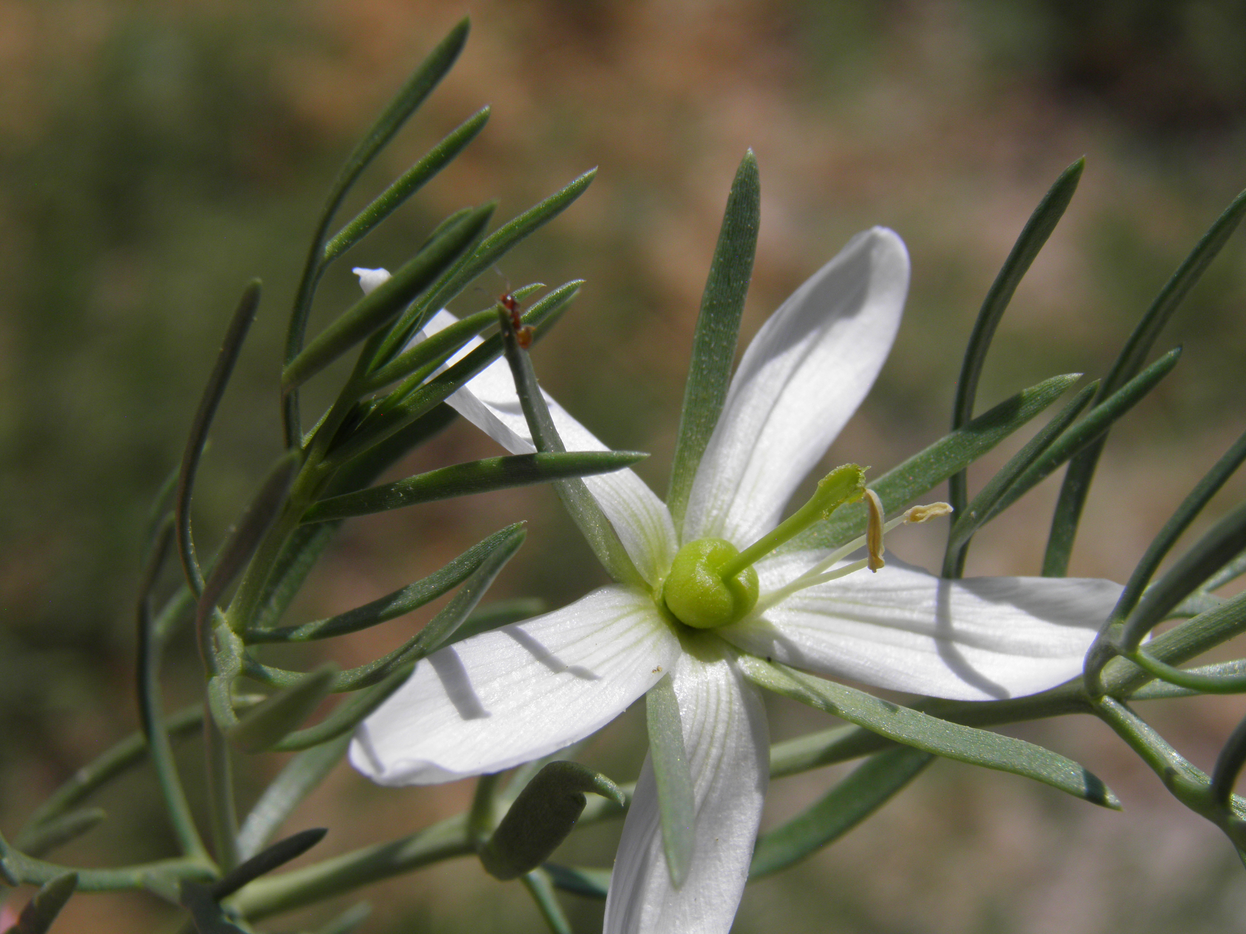
Peganum harmala
African Rue
|
Photographer: E. Wynn Anderson
ID: 0000 0000 1218 0338 (2018-12-08)Copyright © 2018 Wynn Anderson
|
|
INFORMATION PROVIDED WITH THE PHOTO
|
date of photo Aug 1, 2018
latitude 30.96901 longitude 102.90187
View on Google Maps.
location
West 55 Street (Humble Lane), 1.1 miles west of junction with State Highway TX 18, ca. 5.2 miles north of Interstate 10 in Fort Stockton (Pecos County, Texas, US)family
Nitrariaceae
plant community Chihuahuan Desert scrub at 4229' (1289m)notes prolific invasive annual forming extensive stands dominating roadsides crossing flat plain of silty calcareous alluvial soils of former grassland now degraded to Larrea-Prosopis scrub.keywords: CDR, Chihuahuan Desert
contributor's ID # CDR 46 photo category: Plant - annual/perennial
|
MORE INFORMATION ABOUT THIS PLANT
|
| common names
African Rue (photographer)
View all photos in CalPhotos of Peganum harmala Check Google Images for Peganum harmala |
|
The photographer's identification Peganum harmala has not been reviewed. Click here to review or comment on the identification. |
|
Using this photo The thumbnail photo (128x192 pixels) on this page may be freely used for personal or academic purposes without prior permission under the Fair Use provisions of US copyright law as long as the photo is clearly credited with © 2018 Wynn Anderson.
For other uses, or if you have questions, contact E. Wynn Anderson wanderson@UTEP.edu. |
|
|