|
|
click photo for larger file
high resolution: ZOOM browser
view full size

Sporobolus airoides
Alkali Sacaton
|
Photographer: E. Wynn Anderson
ID: 0000 0000 1018 0248 (2018-10-03)Copyright © 2018 Wynn Anderson
|
|
INFORMATION PROVIDED WITH THE PHOTO
|
date of photo May 5, 2018
latitude 30.94146 longitude 104.92927
View on Google Maps.
location
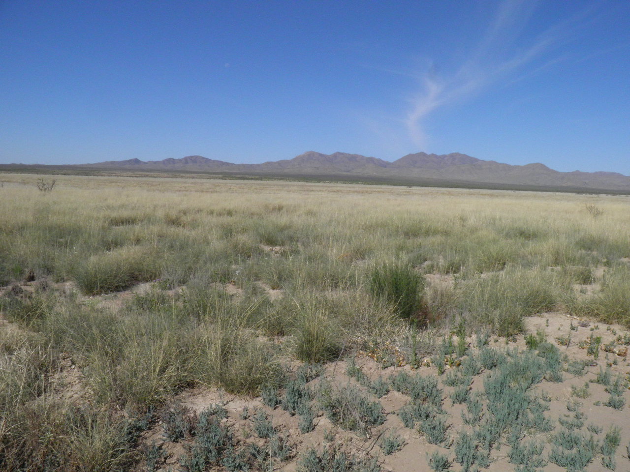
locally graded Southern Pacific Road, 7.2 miles southeast of Mineral Creek-Allamore RR crossing, 1.7 miles northwest of Scott's Crossing (RR), north side of Eagle Flats (Hudspeth County, Texas, US)family
Poaceae
plant community Chihuahuan Desert semi-arid grassland 4154' (1309m)notes Habitat view southwest to Eagle Mountains, across large playa sacaton grassland with scattered forbs in silty calcareous/volcanic soil along northern margin of Eagle Flats, with Glandularia quadrangulata, Heliotropium greggii, Lepidium alyssoides, Gaillardia pinnatifida.keywords: CDR, Chihuahuan Desert, grassland
contributor's ID # CDR 52 photo category: Plant - annual/perennial
|
MORE INFORMATION ABOUT THIS PLANT
|
| common names
Alkali Sacaton (photographer)
View all photos in CalPhotos of Sporobolus airoides Check Google Images for Sporobolus airoides |
|
The photographer's identification Sporobolus airoides has not been reviewed. Click here to review or comment on the identification. |
|
Using this photo The thumbnail photo (128x192 pixels) on this page may be freely used for personal or academic purposes without prior permission under the Fair Use provisions of US copyright law as long as the photo is clearly credited with © 2018 Wynn Anderson.
For other uses, or if you have questions, contact E. Wynn Anderson wanderson@UTEP.edu. |
|
|