|
|
click photo for larger file
high resolution: ZOOM browser
view full size

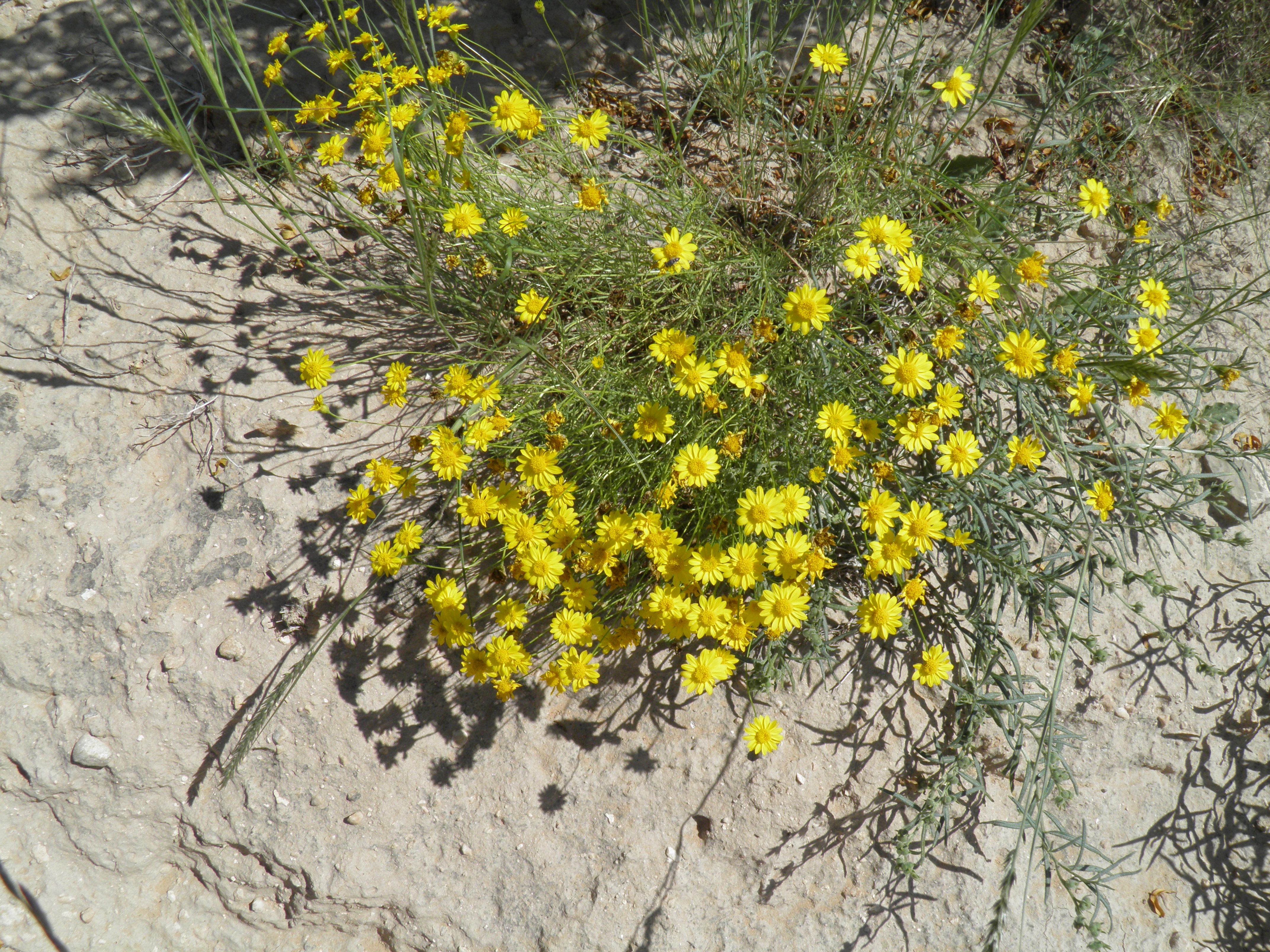
Thymophylla pentachaeta
Dogweed
|
Photographer: E. Wynn Anderson
ID: 0000 0000 0918 1372 (2018-09-10)Copyright © 2018 Wynn Anderson
|
|
INFORMATION PROVIDED WITH THE PHOTO
|
date of photo Sep 15, 2017
latitude 32.35240 longitude 105.18450
View on Google Maps.
location
County Road GO-26 (Pinon Creek Road), 2.8 miles north of State Highway NM 506, 1.7 miles southwest of junction with County Road G-24,west of Crow Flats (Otero County, New Mexico, US)family
Asteraceae
plant community Chihuahuan Desert semi-arid grassland transition to Larrea scrub at 4011' 1222m)notes silty calcareous soils in narrow arroyo drainage between low limestone hills forming northwestern edge of Crow Flatskeywords: CDR, Chihuahuan Desert
contributor's ID # CDR 276 photo category: Plant - annual/perennial
|
MORE INFORMATION ABOUT THIS PLANT
|
| common names
Dogweed, Parralena, Five Needle Pricklyleaf (photographer)
View all photos in CalPhotos of Thymophylla pentachaeta Check Google Images for Thymophylla pentachaeta |
|
The photographer's identification Thymophylla pentachaeta has not been reviewed. Click here to review or comment on the identification. |
|
Using this photo The thumbnail photo (128x192 pixels) on this page may be freely used for personal or academic purposes without prior permission under the Fair Use provisions of US copyright law as long as the photo is clearly credited with © 2018 Wynn Anderson.
For other uses, or if you have questions, contact E. Wynn Anderson wanderson@UTEP.edu. |
|
|