|
|
click photo for larger file
high resolution: ZOOM browser
view full size

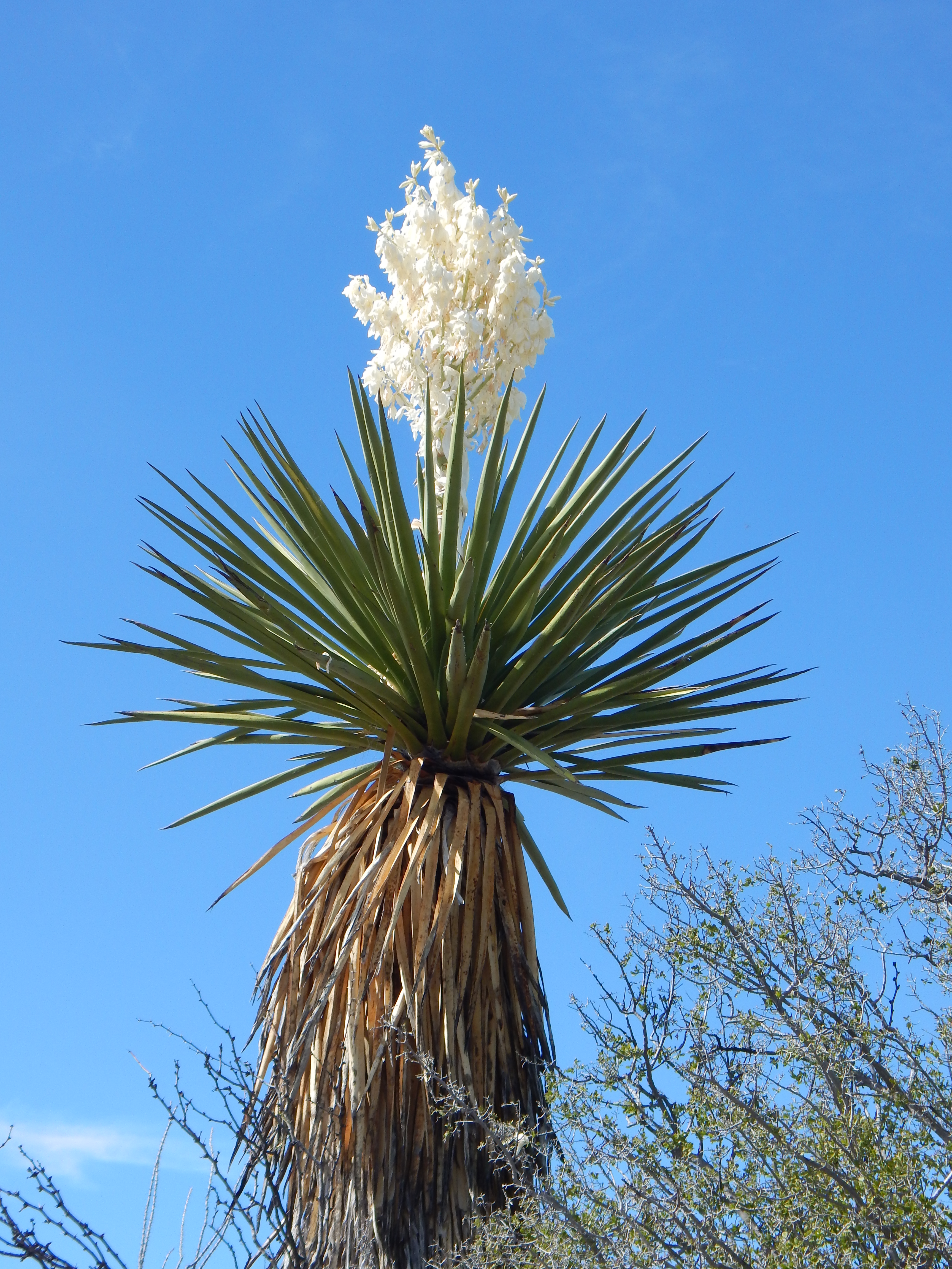
Yucca faxoniana
Giant Yucca
|
Photographer: E. Wynn Anderson
ID: 0000 0000 0218 0375 (2018-02-06)Copyright © 2018 Wynn Anderson
|
|
INFORMATION PROVIDED WITH THE PHOTO
|
date of photo Mar 6, 2015
latitude 29.58990 longitude 102.99970
View on Google Maps.
location
State Highway TX 2627 to La Linda, MX, 6.9 miles southeast of Stillwell Store, 3.6 miles northeast of paved road north to Black Gap WMA HQ ranger station (Brewster County, Texas, US)family
Asparagaceae
plant community Chihuahuan Desert Larrea-Prosopis-Yucca scrub at 2654' (809m)notes Aborescent yucca in mixed alluvial gravels of pale limestone and reddish volcanic rhyolite along shallow arroyo.keywords: CDR, Chihuahuan Desert
contributor's ID # CDR 1374 photo category: Plant - tree
|
MORE INFORMATION ABOUT THIS PLANT
|
| common names
Giant Yucca, Spanish Bayonet, Flor de San Juan (photographer)
View all photos in CalPhotos of Yucca faxoniana Check Google Images for Yucca faxoniana |
|
The photographer's identification Yucca faxoniana has not been reviewed. Click here to review or comment on the identification. |
|
Using this photo The thumbnail photo (128x192 pixels) on this page may be freely used for personal or academic purposes without prior permission under the Fair Use provisions of US copyright law as long as the photo is clearly credited with © 2018 Wynn Anderson.
For other uses, or if you have questions, contact E. Wynn Anderson wanderson@UTEP.edu. |
|
|