|
|
click photo for larger file

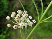
Asclepias subverticillata
Poison Milkweed
|
Photographer: E. Wynn Anderson
ID: 0000 0000 1217 0353 (2017-12-05)Copyright © 2017 Wynn Anderson
|
|
INFORMATION PROVIDED WITH THE PHOTO
|
date of photo Jul 12, 2013
latitude 24.46110 longitude 100.32750
View on Google Maps.
location
Federal highway MX 57, km 103, 16.2 road miles south of junction east with MX 58 at San Roberto, 1.8 road miles north of Refugio de la Ibarra, 3.8 miles south of road east to San Antonio del Salero (Mcp. Galeana, Coahuila, Mexico)family
Apocynaceae
plant community Chihuahuan Desert gypsophilous scrub at 6127' (1866m)notes plants on gypsum mineralized silty clay of bolson playa with halophytic/gypsophilous grasses, forbs & small shrubs; inc. Strotheria, Frankenia, Dicranocarpus, Isocoma, Haploesthes,Tiquilia and Atriplex.keywords: CDR , Chihuahuan Desert, gypsum
contributor's ID # CDR 1023 photo category: Plant - annual/perennial
|
MORE INFORMATION ABOUT THIS PLANT
|
| common names
Poison Milkweed, Horsetail Milkweed (photographer)
View all photos in CalPhotos of Asclepias subverticillata Check Google Images for Asclepias subverticillata |
|
The photographer's identification Asclepias subverticillata has not been reviewed. Click here to review or comment on the identification. |
|
Using this photo The thumbnail photo (128x192 pixels) on this page may be freely used for personal or academic purposes without prior permission under the Fair Use provisions of US copyright law as long as the photo is clearly credited with © 2017 Wynn Anderson.
For other uses, or if you have questions, contact E. Wynn Anderson wanderson@UTEP.edu. |
|
|
