|
|
click photo for larger file

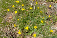
Potentilla zimmeteri
|
Photographer: Dr. Amadej Trnkoczy
ID: 0000 0000 0611 0818 (2011-06-13)Copyright © 2011 Dr. Amadej Trnkoczy
|
|
INFORMATION PROVIDED WITH THE PHOTO
|
date of photo May 6, 2011
latitude 44.54635 longitude 15.17355
View on Google Maps.
location
Dabarski Kukovi north of Baške Oštarije village, middle Velebit Mountains (Velebit, Croatia)family
Rosaceae
notes Syn.: Potentilla heptaphylla subsp. australis (Nyman) Gams; (Potentilla australis agg.) - Slo.: južni petoprstnik? - Habitat: Partly overgrown scree slope, south inclined, calcareous bedrock, open, dry and sunny place, exposed to direct rain, elevation 1.250 m (4.100 feet), alpine phytogeographical region. - Substratum: soil among rocks and scree. - Comment: Determination not completely certain. Taxonomy of Potentilla australis agg. has not been settled yet. - Ref.:(1) Personal communication with dr. Boštjan Surina, University of Primorska, Science and Research Centre of Koper, Slovenia. (2) http://dbiodbs.units.it/carso/chiavi_pub28?usr=admin&n=1168&specie=693#init (3) http://ww2.bgbm.org/EuroPlusMed/PTaxonDetail.asp?NameId=7715413&PTRefFk=7300000camera Canon G11, 6.1-30mm/f2.8-4.5
contributor's ID # Bot_512/2011_IMG4839 photo category: Plant - annual/perennial
|
MORE INFORMATION ABOUT THIS PLANT
|
| View all photos in CalPhotos of Potentilla zimmeteri Check Google Images for Potentilla zimmeteri |
|
The photographer's identification Potentilla zimmeteri has not been reviewed. Click here to review or comment on the identification. |
|
Using this photo The thumbnail photo (128x192 pixels) on this page may be freely used for personal or academic purposes without prior permission under the Fair Use provisions of US copyright law as long as the photo is clearly credited with © 2011 Dr. Amadej Trnkoczy.
For other uses, or if you have questions, contact Dr. Amadej Trnkoczy amadej.trnkoczy[AT]siol.net. (Replace the [AT] with the @ symbol before sending an email.) |
|
|
