|
|
click photo for larger file
high resolution: ZOOM browser
view full size

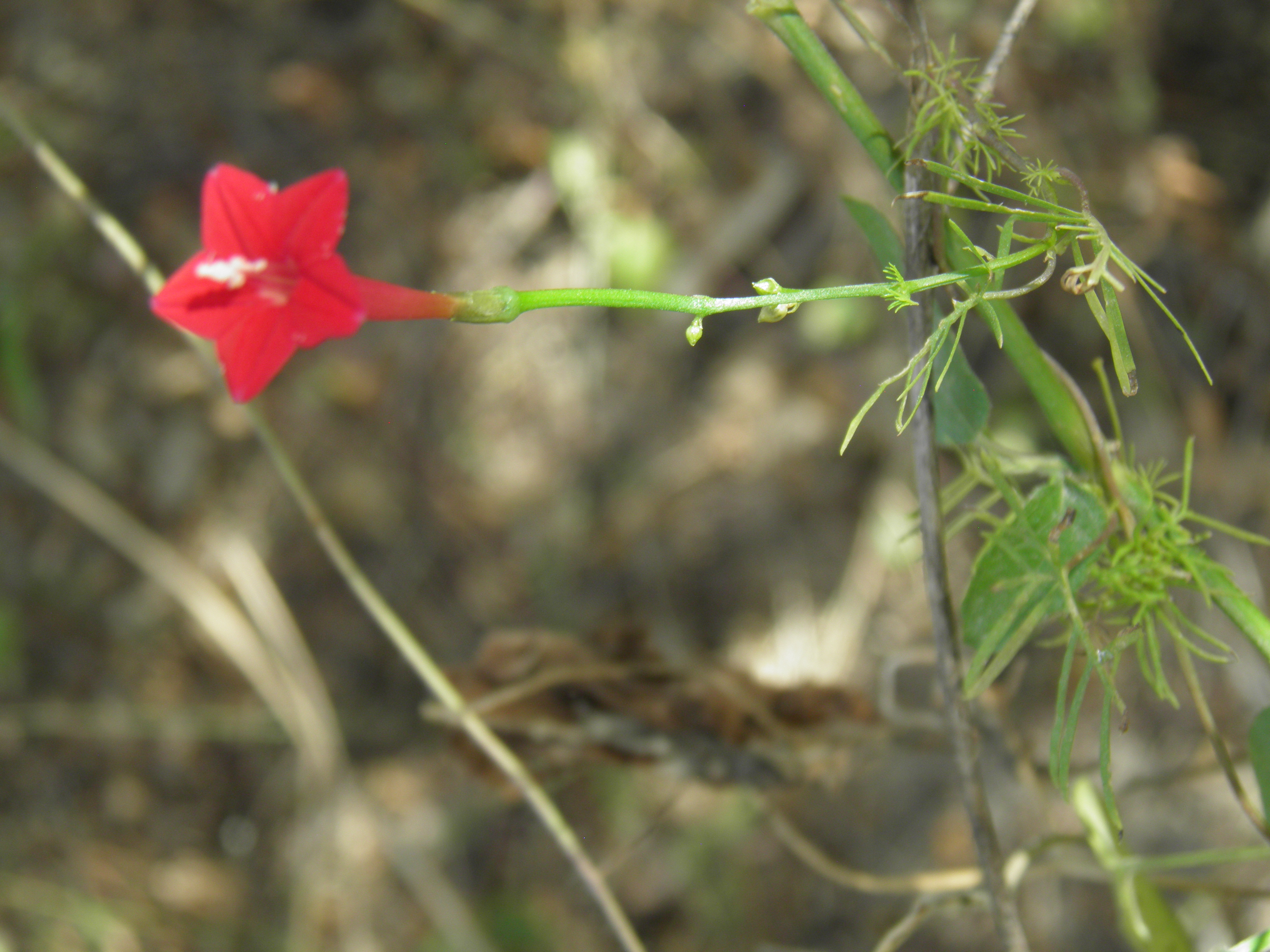
Ipomoea qualmoclit
Cypress Vine
|
Photographer: E. Wynn Anderson
ID: 0000 0000 0124 1378 (2024-01-23)Copyright © 2024 Wynn Anderson
|
|
INFORMATION PROVIDED WITH THE PHOTO
|
date of photo Nov 28, 2016
latitude 23.37910 longitude 110.05230
View on Google Maps.
location
rural dirt road between San Andres and El Barranco, 9.6 mi. E of MX 19 at El Pescadero, 0.3 mi. S of lower fork north to San Andres,3.6 miles south of side road to El Barranco (Municpio La Paz, Baja California Sur, Mexico)family
Convolvulaceae
plant community thicket, mixed transition of sacrocaulescent shrub desert to foothill desert leguminous tree/shrub community at an elevation of 345 meters (1131 feet)notes Site is in the topographic transition from flat coastal plain to the low rise of the western fault zone uplifting the frontal foothills of the Sierra La Lagunakeywords: Baja, BCs, BCSur
contributor's ID # BCs 168 photo category: Plant - vine
|
MORE INFORMATION ABOUT THIS PLANT
|
| common names
Cypress Vine, Cardinal Climber (photographer)
View all photos in CalPhotos of Ipomoea qualmoclit Check Google Images for Ipomoea qualmoclit |
|
The photographer's identification Ipomoea qualmoclit has not been reviewed. Click here to review or comment on the identification. |
|
Using this photo The thumbnail photo (128x192 pixels) on this page may be freely used for personal or academic purposes without prior permission under the Fair Use provisions of US copyright law as long as the photo is clearly credited with © 2024 Wynn Anderson.
For other uses, or if you have questions, contact E. Wynn Anderson wanderson@UTEP.edu. |
|
|