|
|
click photo for larger file
high resolution: ZOOM browser
view full size

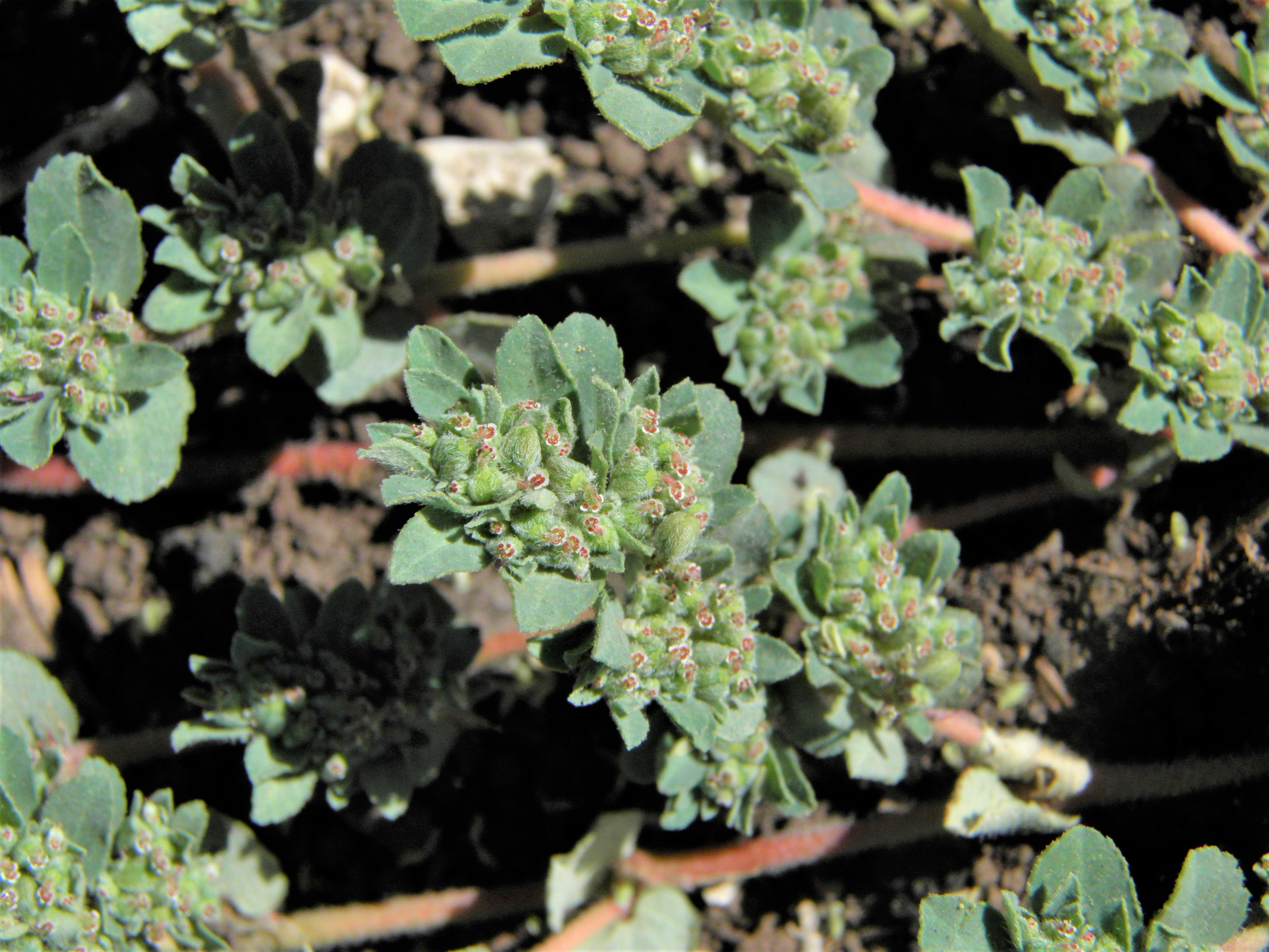
Chamaesyce strictospora
Slimseed Spurge
|
Photographer: E. Wynn Anderson
ID: 0000 0000 0421 0172 (2021-04-04)Copyright © 2021 Wynn Anderson
|
|
INFORMATION PROVIDED WITH THE PHOTO
|
date of photo Sep 1, 2013
latitude 32.91187 longitude 105.46520
View on Google Maps.
location
Forest Service road FS 607(Carr Canyon Road), 0.1 mile west off off hiway US 82 mile marker 36, 1.6 miles northeast of Mayhill, Sacramento Mts. (Otero Co. County, New Mexico, US)family
Euphorbiaceae
plant community former Pinyon-Juniper-Oak woodland, severely burned over in 2002, now recovering as post-fire grassland at 6535 feet (1992 meters) elevationnotes area subject to a major forest fire in 2002 and is now an open post fire grassland with abundent grasses and forbs and a few scattered stump resprout of trees and shrubs on crest of low gravelly limestone hill with dark sandy calcareous loam above the Rio Penasco River valleykeywords: Sacramento Mts., Sac.
contributor's ID # Sac.83 photo category: Plant - annual/perennial
|
MORE INFORMATION ABOUT THIS PLANT
|
| common names
Slimseed Spurge (photographer)
View all photos in CalPhotos of Chamaesyce strictospora Check Google Images for Chamaesyce strictospora |
|
The photographer's identification Chamaesyce strictospora has not been reviewed. Click here to review or comment on the identification. |
|
Using this photo The thumbnail photo (128x192 pixels) on this page may be freely used for personal or academic purposes without prior permission under the Fair Use provisions of US copyright law as long as the photo is clearly credited with © 2021 Wynn Anderson.
For other uses, or if you have questions, contact E. Wynn Anderson wanderson@UTEP.edu. |
|
|