|
|
click photo for larger file

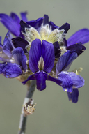
Psorothamnus scoparius
Broom Dalea
|
Photographer: Richard Spellenberg
ID: 0000 0000 0520 0967 (2020-05-19)Copyright © 2020 Richard Spellenberg
|
|
INFORMATION PROVIDED WITH THE PHOTO
|
date of photo May 19, 2020
latitude 32.34545 longitude -106.76546
View on Google Maps.
location
NE quadrant of Las Cruces, Telshor Blvd. 0.8 km S of US Hwy 70 (Dona Ana County, New Mexico, US)family
Fabaceae
plant community Sandy arroyo bank in remnant vegetation, with Prosopis, Larrea; elev. 1240 m.camera Nikon D7100, Sigma 105 macro
photo category: Plant - shrub
|
MORE INFORMATION ABOUT THIS PLANT
|
| common names
Broom Dalea (photographer)
View all photos in CalPhotos of Psorothamnus scoparius Check Google Images for Psorothamnus scoparius |
|
The photographer's identification Psorothamnus scoparius has not been reviewed. Sign in to review or comment on this photo |
|
Using this photo The thumbnail photo (128x192 pixels) on this page may be freely used for personal or academic purposes without prior permission under the Fair Use provisions of US copyright law as long as the photo is clearly credited with © 2020 Richard Spellenberg.
For other uses, or if you have questions, contact Richard Spellenberg rwspellystuff[AT]gmail.com. (Replace the [AT] with the @ symbol before sending an email.) |
|
|
