|
|
click photo for larger file
high resolution: ZOOM browser
view full size

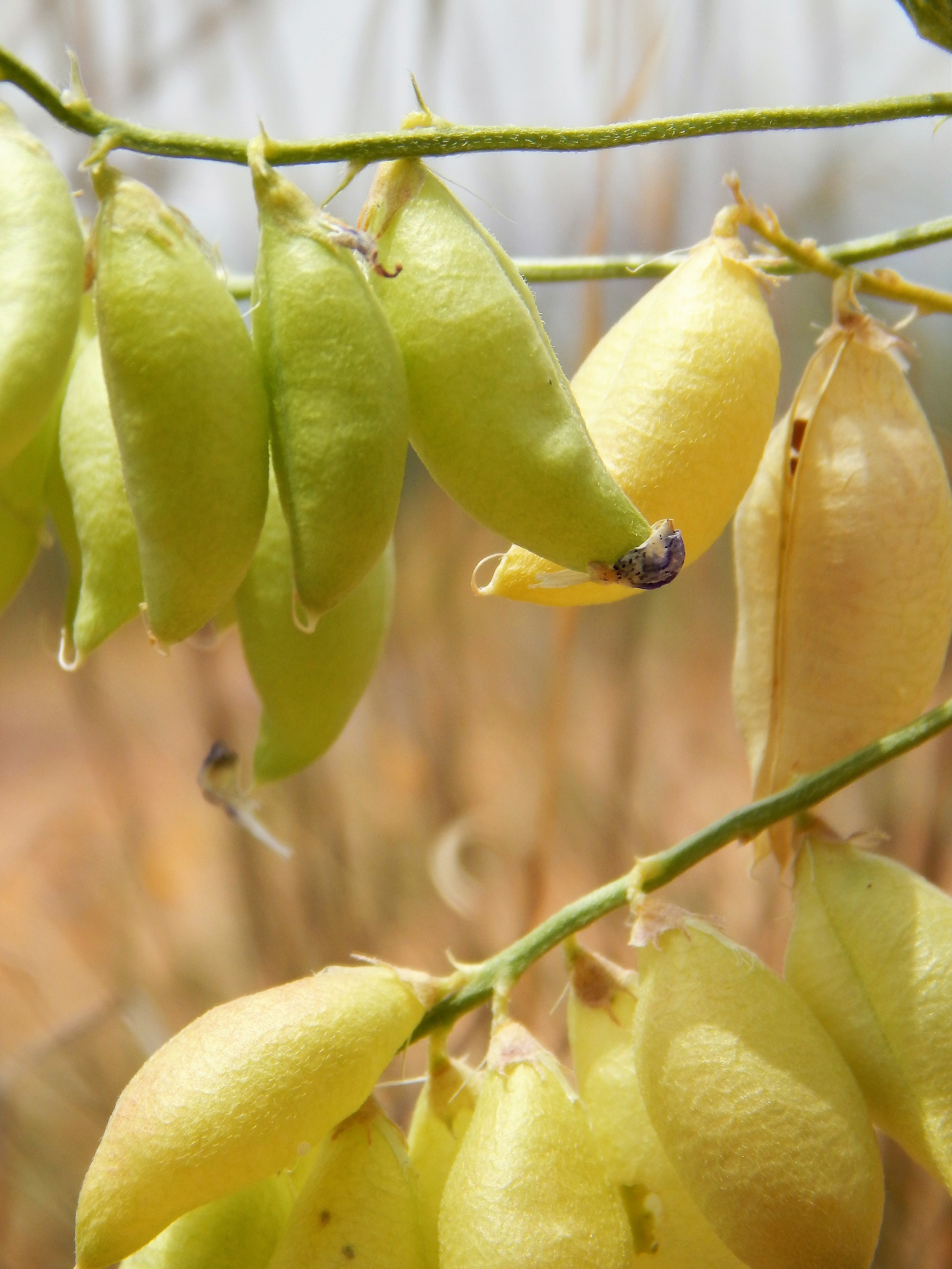
Astragalus allochrous
Halfmoon Locoweed
|
Photographer: E. Wynn Anderson
ID: 0000 0000 0119 1074 (2019-01-08)Copyright © 2019 Wynn Anderson
|
|
INFORMATION PROVIDED WITH THE PHOTO
|
date of photo May 22, 2014
latitude 31.96470 longitude 106.37630
View on Google Maps.
location
Federal Highway US 54, 0.2 mile southwest of crossing of Mesquite Hill Drive, 3.8 miles southwest of state line into New Mexico, El Paso (El Paso County, Texas, US)family
Fabaceae
plant community Chihuahuan Desert mesquite sand scrub at 4025' (1227m)notes trailing perennial on low reddish aeolian deposited sand hummocks of bolson plain. View of inflated fruit, apically abrupt up turned.keywords: CDR, Chihuahuan Desert, sand
contributor's ID # CDR 10 photo category: Plant - annual/perennial
|
MORE INFORMATION ABOUT THIS PLANT
|
| common names
Halfmoon Locoweed (photographer)
View all photos in CalPhotos of Astragalus allochrous Check Google Images for Astragalus allochrous |
|
The photographer's identification Astragalus allochrous has not been reviewed. Sign in to review or comment on this photo |
|
Using this photo The thumbnail photo (128x192 pixels) on this page may be freely used for personal or academic purposes without prior permission under the Fair Use provisions of US copyright law as long as the photo is clearly credited with © 2019 Wynn Anderson.
For other uses, or if you have questions, contact E. Wynn Anderson wanderson@UTEP.edu. |
|
|