|
|
click photo for larger file
high resolution: ZOOM browser
view full size

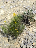
Haploesthes greggii var. texana
False Texas Broomweed
(shown with Nerisyrenia hypercorax)
|
Photographer: E. Wynn Anderson
ID: 0000 0000 0418 1128 (2018-04-16)Copyright © 2018 Wynn Anderson
|
|
INFORMATION PROVIDED WITH THE PHOTO
|
date of photo Aug 20, 2013
latitude 32.37840 longitude 105.06980
View on Google Maps.
location
lower/basal slopes of Guadalupe Rim escarpment , northwest side of the Pup Canyon mouth, 4.6 air miles north-north west of Rauch Ranch on County road GO24 crossing Crow Flats , ca. 31 air miles north of Dell City (center), TX (Otero County, New Mexico, US)family
Asteraceae
plant community Chihuahuan Desert gypsophilic scrub at 4488' (1370m)notes on grayish crust of weathered gypsum re-cementing gravels of anhydrite gypsum and calcareous shaley limestone substrate exposed on SW facing lower foothill slopes of the escarpment, with endemic Anulocaulis leiosolensis v. howardii, Mentzelia humilis v. guadalupensis, Nerisyrenia hypercorax.keywords: CDR, Chihuahuan Desert, gypsum
photo category: Plant - annual/perennial
|
MORE INFORMATION ABOUT THIS PLANT
|
| common names
False Texas Broomweed (photographer)
View all photos in CalPhotos of Haploesthes greggii var. texana Check Google Images for Haploesthes greggii var. texana |
|
The photographer's identification Haploesthes greggii var. texana has not been reviewed. Sign in to review or comment on this photo |
|
Using this photo The thumbnail photo (128x192 pixels) on this page may be freely used for personal or academic purposes without prior permission under the Fair Use provisions of US copyright law as long as the photo is clearly credited with © 2018 Wynn Anderson.
For other uses, or if you have questions, contact E. Wynn Anderson wanderson@UTEP.edu. |
|
|
