|
|
click photo for larger file
high resolution: ZOOM browser
view full size

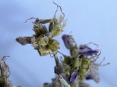
Psorothamnus scoparius
Broom Dalea
|
Photographer: E. Wynn Anderson
ID: 0000 0000 0118 2101 (2018-01-25)Copyright © 2018 Wynn Anderson
|
|
INFORMATION PROVIDED WITH THE PHOTO
|
date of photo Sep 25, 2016
latitude 31.82590 longitude 107.30600
View on Google Maps.
location
State Highway NM 9, mm 109, ca. 7 miles east of bolson escarpment breaks near old Arena RR siding/ cattle pens, 0.5 miles west of County line (Luna Co. County, New Mexico, US)family
Fabaceae
plant community Chihuahuan Desert sand scrub at 4170' (1271m)notes Immature legume view. Profusely branching shrubs on disturbed roadside soil in semi-stabilized mesquite hummock dunes covering basalt flows on flat plains of the Mesilla Bolson surface. Flowers are frequently tardily deciduous perhaps to help protect very immature fruits from drying windskeywords: CDR, Chihuahuan Desert
contributor's ID # CDR 121 photo category: Plant - shrub
|
MORE INFORMATION ABOUT THIS PLANT
|
| common names
Broom Dalea (photographer)
View all photos in CalPhotos of Psorothamnus scoparius Check Google Images for Psorothamnus scoparius |
|
The photographer's identification Psorothamnus scoparius has not been reviewed. Sign in to review or comment on this photo |
|
Using this photo The thumbnail photo (128x192 pixels) on this page may be freely used for personal or academic purposes without prior permission under the Fair Use provisions of US copyright law as long as the photo is clearly credited with © 2018 Wynn Anderson.
For other uses, or if you have questions, contact E. Wynn Anderson wanderson@UTEP.edu. |
|
|
