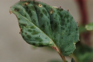
INFORMATION PROVIDED WITH THE PHOTO
|
date of photo May 21, 2011
latitude 39.27528 longitude -118.41222 max error distance 3036 meters
View on Google Maps.
horizontal datum World Geodetic System 1984 georeferencing source GeoLocategeoreferencing remarks Adjusted uncertainty according to half way distance between the station and Sand Mountain Windmilllocation
Sand Springs Pony Express Station (Churchill County, Nevada, US)family
Onagraceae
synonyms Camissonia claviformis ssp. integrior
camera Nikon D-100
contributor's ID # CACLI_4; gam152 photo category: Plant - annual/perennial
|
ADDITIONAL TAXONOMIC NOTES FOR THIS PHOTO
|
| name change notes Feb 19 2025: Plants of the World (POTW) update via script. Previous name: Camissonia claviformis ssp. integrior ; updated name: Chylismia claviformis ssp. integrior |
MORE INFORMATION ABOUT THIS PLANT
|
| common names
Browneyes (photographer)
View all photos in CalPhotos of Chylismia claviformis ssp. integrior Check Google Images for Chylismia claviformis ssp. integrior |
