|
|
click photo for larger file

Tauschia parishii
|
Photographer: Larry Blakely
ID: 0000 0000 0509 2473 (2009-05-23)Copyright © 2009 Larry Blakely
|
|
INFORMATION PROVIDED WITH THE PHOTO
|
date of photo May 18, 2009
latitude 35.37390 longitude -118.16290
View on Google Maps.
location
Jawbone Canyon Rd., 15.2 miles in from junction with SR 14, elevation 1490 m. (Kern County, California, US)family
Apiaceae
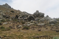
notes Habitat shot; photog's wife Ruth stands where she found the plants at the base of Butterbredt Peak.camera Canon SD600
contributor's ID # Tauschia_parishii_20090518_35.3739_118.1629_1490_Jawbone_1973 photo category: Plant - annual/perennial
|
MORE INFORMATION ABOUT THIS PLANT
|
| Look for Jepson Manual treatments, maps (University & Jepson Herbaria)View Calflora record for Tauschia parishiiView all photos in CalPhotos of Tauschia parishii Check Google Images for Tauschia parishii |
|
The photographer's identification Tauschia parishii has not been reviewed. Sign in to review or comment on this photo |
|
Using this photo This photo is in the public domain and may be freely used for any purpose. Please credit the photographer Larry Blakely.
If you have questions, contact Larry Blakely ruthnlarryssr[AT]gmail.com. |
|
|
