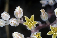
INFORMATION PROVIDED WITH THE PHOTO
|
date of photo May 6, 2000
latitude 37.20519 longitude -121.70236 max error distance 5670 meters
View on Google Maps.
horizontal datum World Geodetic System 1984 georeferencing source GEOLocategeoreferencing remarks Based on http://www.openspaceauthority.org/preservation/coyoteridge.htmllocation
In the general vicinity of Coyote Ridge (Santa Clara County, California, US)family
Crassulaceae
synonyms Dudleya setchellii
camera Kodachrome 64 slide, 35mm.
contributor's ID # 044-293 photo category: Plant - annual/perennial
|
ADDITIONAL TAXONOMIC NOTES FOR THIS PHOTO
|
| name change notes May 21 2014: TJM1->TJM2 update via script. TJM1 name: Dudleya setchellii ; TJM2 name: Dudleya abramsii ssp. setchellii |
MORE INFORMATION ABOUT THIS PLANT
|
| Look for Jepson Manual treatments, maps (University & Jepson Herbaria)View Calflora record for Dudleya abramsii ssp. setchelliiView all photos in CalPhotos of Dudleya abramsii ssp. setchellii Check Google Images for Dudleya abramsii ssp. setchellii |
