|
|
click photo for larger file

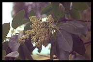
Arbutus menziesii
Madrone
|
Photographer: William R. Hewlett
Organization: California Academy of Sciences
Collection: CalAcademy
ID: 8265 3262 1202 0026 (1999-11-22)Copyright © 1999 California Academy of Sciences
|
|
INFORMATION PROVIDED WITH THE PHOTO
|
date of photo Apr 24, 1977
latitude 37.26142 longitude -121.61749 max error distance 9236 meters
View on Google Maps.
horizontal datum World Geodetic System 1984 georeferencing source GeoLocategeoreferencing remarks Couldn't georeference more specifically than San Felipe Ranch, elevation did not help. Used google search to determine bounds of the ranch.location
San Felipe ranch, Madrone Open wood near 360 acre field, 1500' (Santa Clara County, California, US)family
Ericaceae
notes MadroneCalAcademy slide # WH 26photo category: Plant - tree
|
MORE INFORMATION ABOUT THIS PLANT
|
| common names
Pacific Madrone, Madrone (CF, ITIS )
Madrone (photographer)
Look for Jepson Manual treatments, maps (University & Jepson Herbaria)View Calflora record for Arbutus menziesiiView all photos in CalPhotos of Arbutus menziesii Check Google Images for Arbutus menziesii |
|
The photographer's identification Arbutus menziesii has not been reviewed. Sign in to review or comment on this photo |
|
Using this photo The thumbnail photo (128x192 pixels) on this page may be freely used for personal or academic purposes without prior permission under the Fair Use provisions of US copyright law as long as the image is clearly credited with William R. Hewlett © California Academy of Sciences.
Permission is granted to use the enlargement
for personal, academic, or non-profit purposes as long as
the user fills out the following form: https://forms.gle/R2ZUig8o8iYj4TrW9
and the image is clearly credited with
William R. Hewlett © California Academy of Sciences.
For higher resolution images or commercial use please
fill out this form: https://forms.gle/QKoVskQBcnYZPbrD6.
Please make sure to include the 16 digit ID number for the image.
|
|
|
