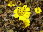
INFORMATION PROVIDED WITH THE PHOTO
|
date of photo Oct 20, 2007
latitude 34.67776 longitude -120.43041 max error distance 974 meters
View on Google Maps.
horizontal datum World Geodetic System 1984 georeferencing source GEOLocategeoreferencing remarks Assume Harris Grade summit is Harris Grade Road.location
Purisima Hills, approx .4 miles SE of Harris Grade summit (Santa Barbara County, California, US)family
Asteraceae
synonyms Hemizonia paniculata
camera Nikon Coolpix P3
photo category: Plant - annual/perennial
|
ADDITIONAL TAXONOMIC NOTES FOR THIS PHOTO
|
| name change notes May 21 2014: TJM1->TJM2 update via script. TJM1 name: Hemizonia paniculata ; TJM2 name: Deinandra paniculata |
MORE INFORMATION ABOUT THIS PLANT
|
| common names
San Diego Tarweed (photographer)
Look for Jepson Manual treatments, maps (University & Jepson Herbaria)View Calflora record for Deinandra paniculataView all photos in CalPhotos of Deinandra paniculata Check Google Images for Deinandra paniculata |
