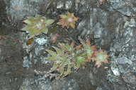
INFORMATION PROVIDED WITH THE PHOTO
|
date of photo Mar 24, 2005
latitude 37.00752 longitude -121.70764 max error distance 400 meters
View on Google Maps.
horizontal datum World Geodetic System 1984 georeferencing source GEOLocategeoreferencing remarks Appears to be only waterway leading to Sprig Lake. Error is half length of nears populated named place.location
headwaters unnamed creek tributary Sprig Lake, Mt Madonna County Park (Santa Clara County, California, US)family
Crassulaceae
synonyms Dudleya setchellii
photo category: Plant - annual/perennial
|
ADDITIONAL TAXONOMIC NOTES FOR THIS PHOTO
|
| name change notes May 21 2014: TJM1->TJM2 update via script. TJM1 name: Dudleya setchellii ; TJM2 name: Dudleya abramsii ssp. setchellii |
MORE INFORMATION ABOUT THIS PLANT
|
| Look for Jepson Manual treatments, maps (University & Jepson Herbaria)View Calflora record for Dudleya abramsii ssp. setchelliiView all photos in CalPhotos of Dudleya abramsii ssp. setchellii Check Google Images for Dudleya abramsii ssp. setchellii |
