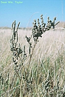
INFORMATION PROVIDED WITH THE PHOTO
|
date of photo Aug 6, 1989
latitude 38.32725 longitude -122.01181 max error distance 270 meters
View on Google Maps.
horizontal datum World Geodetic System 1984 georeferencing source GeoLocatelocation
Lagoon Valley, on SE shore of lake (reached from Lagoon Valley road 0.4 miles E of Interstate 80) (Solano County, California, US)family
Chenopodiaceae
synonyms Atriplex joaquiniana
Atriplex joaquinana
notes vouchered by Dean Wm. Taylor #10507 (JEPS90657)From the collection of the University and Jepson Herbaria Accession No. JEPS90657 View all photos for this specimen
photo category: Plant - annual/perennial
|
ADDITIONAL TAXONOMIC NOTES FOR THIS PHOTO
|
| name change notes May 21, 2014: TJM1 name Atriplex joaquiniana changed to TJM2 name Atriplex joaquinana . (University & Jepson Herbaria) |
ADDITIONAL TAXONOMIC NOTES FOR THIS PHOTO
|
| name change notes May 21, 2014: Name changed from Atriplex joaquinana to ICPN-accepted name Extriplex joaquinana . (University & Jepson Herbaria) |
MORE INFORMATION ABOUT THIS PLANT
|
| common names
San Joaquin Spearscale (CF, ITIS )
Look for Jepson Manual treatments, maps (University & Jepson Herbaria)View Calflora record for Extriplex joaquinanaView all photos in CalPhotos of Extriplex joaquinana Check Google Images for Extriplex joaquinana |
