|
|
click photo for larger file
high resolution: ZOOM browser
view full size

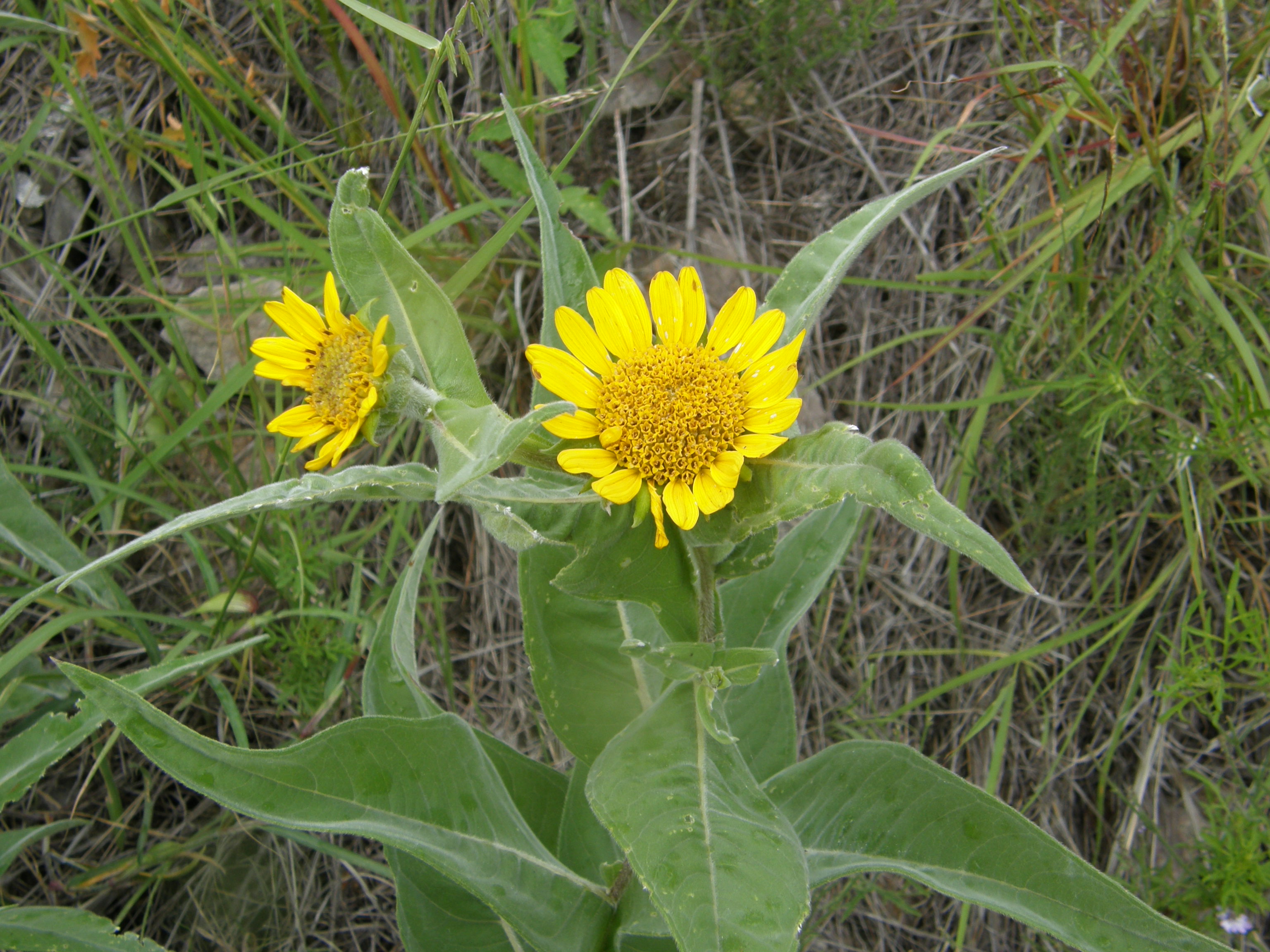
Viguiera decurrens
Yerba de La Mula
|
Photographer: E. Wynn Anderson
ID: 0000 0000 0822 0519 (2022-08-15)Copyright © 2022 Wynn Anderson
|
|
INFORMATION PROVIDED WITH THE PHOTO
|
date of photo Oct 14, 2011
latitude 29.75770 longitude 107.52370
View on Google Maps.
location
State Hiway CH 5, km 232, 7.8 miles SW of San Buenaventura, (Mcp. Buenaventura, Chihuahua, Mexico)family
Asteraceae
plant community in semi-arid grassland with scattered oaks at 6161' (1878m)notes perennials on volcanic rhyolitic soil and substrate at lower edge of excavated roadbed spillage downslope on a moderate hillside slope, northside above El Vallecillo canyon in the Sierra La Catarinakeywords: SMOc.
contributor's ID # SMOc 9464 photo category: Plant - annual/perennial
|
MORE INFORMATION ABOUT THIS PLANT
|
| common names
Yerba de La Mula (photographer)
View all photos in CalPhotos of Viguiera decurrens Check Google Images for Viguiera decurrens |
|
The photographer's identification Viguiera decurrens has not been reviewed. Click here to review or comment on the identification. |
|
Using this photo The thumbnail photo (128x192 pixels) on this page may be freely used for personal or academic purposes without prior permission under the Fair Use provisions of US copyright law as long as the photo is clearly credited with © 2022 Wynn Anderson.
For other uses, or if you have questions, contact E. Wynn Anderson wanderson@UTEP.edu. |
|
|