|
|
click photo for larger file
high resolution: ZOOM browser
view full size

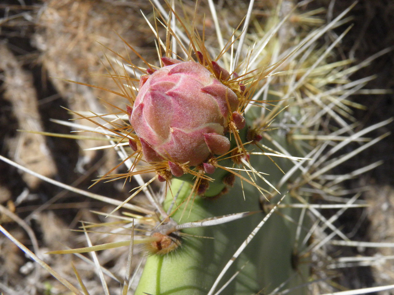
Opuntia littoralis
Coastal Pricklypear
|
Photographer: E. Wynn Anderson
ID: 0000 0000 0818 0722 (2018-08-08)Copyright © 2018 Wynn Anderson
|
|
INFORMATION PROVIDED WITH THE PHOTO
|
date of photo May 17, 2018
latitude 30.97650 longitude 116.09860
View on Google Maps.
location
paved highway to Rancho Meling and National Observatory, 4.8 miles east of junction with Federal Highway MX 1 at Rancho Cepeda, 1.0 mile northwest of San Telmo, (Baja California, Mexico)family
Cactaceae
plant community coastal scrub to inland chaparral at elv. 3761' (1146m)notes large erect to sprawling succulent shrubs scattered on low slope of mixed alluvial gravels and sandy soilkeywords: BCn, Baja
contributor's ID # BCn 463 photo category: Plant - shrub
|
MORE INFORMATION ABOUT THIS PLANT
|
| common names
Coastal Pricklypear (photographer)
View all photos in CalPhotos of Opuntia littoralis Check Google Images for Opuntia littoralis |
|
The photographer's identification Opuntia littoralis has not been reviewed. Click here to review or comment on the identification. |
|
Using this photo The thumbnail photo (128x192 pixels) on this page may be freely used for personal or academic purposes without prior permission under the Fair Use provisions of US copyright law as long as the photo is clearly credited with © 2018 Wynn Anderson.
For other uses, or if you have questions, contact E. Wynn Anderson wanderson@UTEP.edu. |
|
|