|
|
click photo for larger file
high resolution: ZOOM browser
view full size

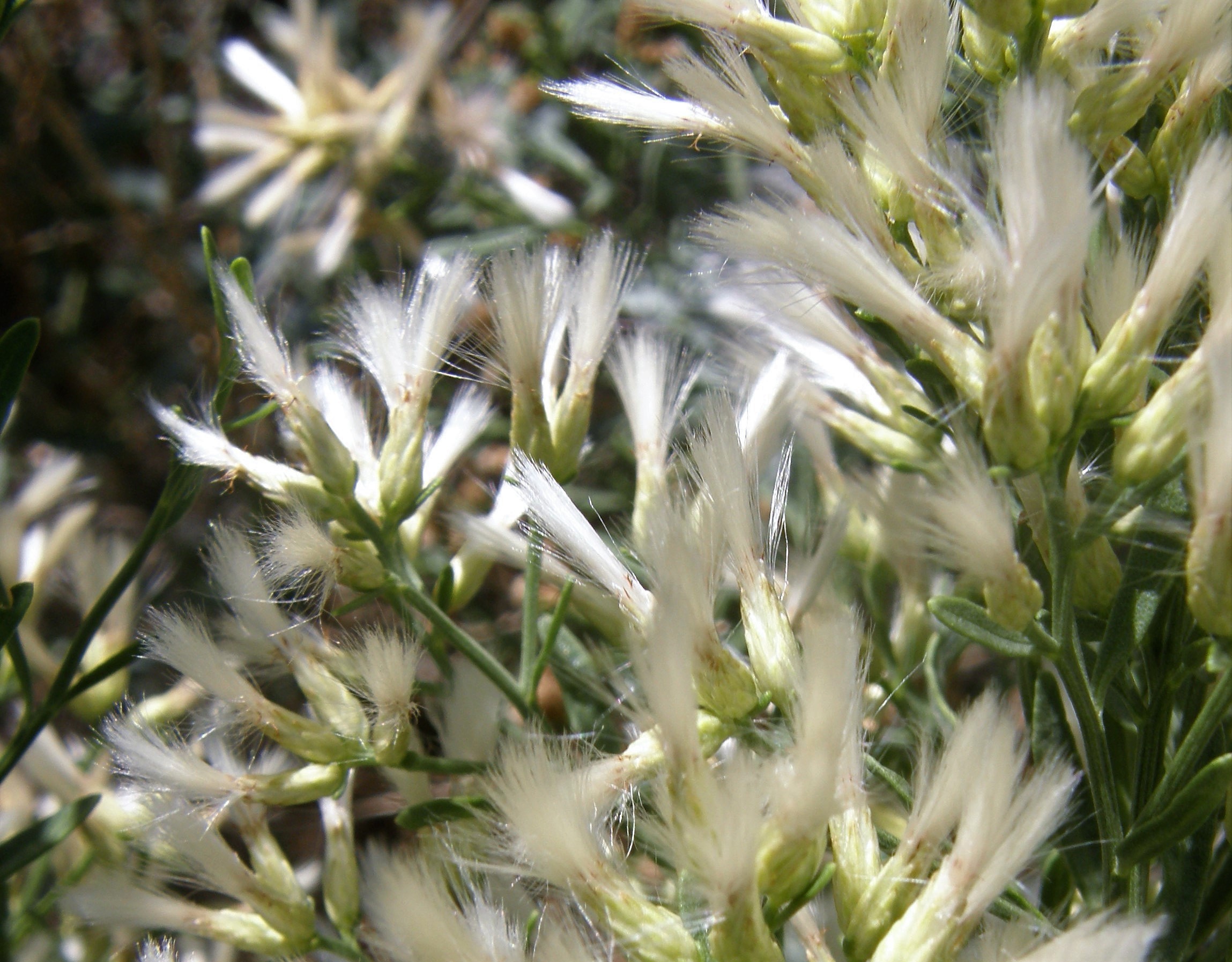
Baccharis salicina
Willow Baccharis
|
Photographer: E. Wynn Anderson
ID: 0000 0000 0418 0788 (2018-04-11)Copyright © 2018 Wynn Anderson
|
|
INFORMATION PROVIDED WITH THE PHOTO
|
date of photo Aug 20, 2008
latitude 31.85720 longitude 104.24730
View on Google Maps.
location
State Highway TX-RM 652, 21.2 miles west of junction with US 285 in Orla, 6.5 miles northwest of junction TX-FM 3541 south, 20.3 miles southeast of junction with US 62 at State Line (Culberson County, Texas, US)family
Asteraceae
plant community Chihuahuan Desert gypsophilic scrub at 3587' (1093m)notes large shrub in drainage swale below low roadcut in a bajada of re-cemented weathered anhydrite (gypsum) & silty limestone rubble below hillside exposures of the Castile Formationkeywords: CDR, Chihuahuan Desert, gypsum
contributor's ID # CDR 64 photo category: Plant - shrub
|
MORE INFORMATION ABOUT THIS PLANT
|
| common names
Willow Baccharis, Emory's Baccharis (photographer)
View all photos in CalPhotos of Baccharis salicina Check Google Images for Baccharis salicina |
|
The photographer's identification Baccharis salicina has not been reviewed. Click here to review or comment on the identification. |
|
Using this photo The thumbnail photo (128x192 pixels) on this page may be freely used for personal or academic purposes without prior permission under the Fair Use provisions of US copyright law as long as the photo is clearly credited with © 2018 Wynn Anderson.
For other uses, or if you have questions, contact E. Wynn Anderson wanderson@UTEP.edu. |
|
|