|
|
click photo for larger file

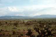
10 km S, 2 km W Sombrerete, Zacatecas, Mexico
|
Photographer: Mark S. Hafner
Collection: MVZ
ID: 0000 3333 1721 2859 (2016-06-09)Copyright © Museum of Vertebrate Zoology, University of California, Berkeley
|
|
INFORMATION PROVIDED WITH THE PHOTO
|
date of photo Jul 22, 1977
latitude 23.61663 longitude -103.73016 max error distance 4310 meters
View on Google Maps.
horizontal datum North American Datum 1927 georeferencing source Instituto Nacional de Estadística Geografía e Informática (INEGI), (2002) Localidades de la República Mexicana, 2000. Obtenido de Principales Resultados por Localidad. XII Censo de Población y Viviendgeoreferencing remarks CONABIO suggests: Zacatecas ; Sombrerete ; Sombrerete, 10 km S y 2 km Wlocation
10 km S, 2 km W Sombrerete (Zacatecas, Mexico)description trap locality southwest of Somberete, ZacatecasMVZ database record for this image MVZ 13435From the collection of the Museum of Vertebrate Zoology photo category: Landscape - habitat
batch id: batchid_2016-06-09_19:18:01_5200
|
| |
|
Using this photo The thumbnail photo (128x192 pixels) on this page may be freely used for personal or academic purposes without prior permission under the Fair Use provisions of US copyright law as long as notification of use is sent to mvzarchives@berkeley.edu and the image is clearly credited with © 2007 Museum of Vertebrate Zoology. For other uses, or if you have questions, contact Museum of Vertebrate Zoology, University of California, Berkeley (mvzarchives@berkeley.edu). |
|
|
