|
|
click photo for larger file

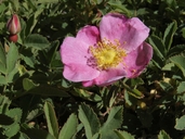
Rosa woodsii var. ultramontana
Western Wildrose
|
Photographer: James Morefield
ID: 0000 0000 1116 0312 (2016-11-03)Copyright © 2016 James Morefield
|
|
INFORMATION PROVIDED WITH THE PHOTO
|
date of photo Jun 23, 2014
latitude 37.49855 longitude -118.11219
View on Google Maps.
location
White Mountains, 9490 ft (2893 m), Deep Springs Valley drainage, along Crooked Creek between Deep Springs Cow Camp and South Fork. (Mono County, California, US)family
Rosaceae
plant community Moist sod in subalpine riparian meadow.notes Latitude and Longitude are WGS84 +/- 5 meters.keywords: 'Rose Family' Rosa 'Rosa woodsii' angiosperms dicots shrubs 'White Mountains' 'Crooked Creek' 'Inyo National Forest' summer 'Great Basin'
camera Olympus E-510 DSLR, Zuiko Digital 14-42mm kit lens
contributor's ID # JDM20141144 high resolution file https://www.flickr.com/search/?user_id=127605180%40N04&view_all=1&tags=JDM20141144&media=photos
photo category: Plant - shrub
|
MORE INFORMATION ABOUT THIS PLANT
|
| common names
Western Wildrose (photographer)
Look for Jepson Manual treatments, maps (University & Jepson Herbaria)View Calflora record for Rosa woodsii var. ultramontanaView all photos in CalPhotos of Rosa woodsii var. ultramontana Check Google Images for Rosa woodsii var. ultramontana |
|
The photographer's identification Rosa woodsii var. ultramontana has not been reviewed. Sign in to review or comment on this photo |
|
Using this photo The thumbnail photo (128x192 pixels) on this page may be freely used for personal or academic purposes without prior permission under the Fair Use provisions of US copyright law as long as the photo is clearly credited with © 2016 James Morefield.
For other uses, or if you have questions, contact James Morefield jdmore14_NO_SPAM@gmail.com. (Remove "_NO_SPAM" from this email address before sending an email.) |
|
|
