|
|
click photo for larger file

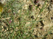
Dalea filiformis
Sonoran Prarie Clover
|
Photographer: E. Wynn Anderson
ID: 0000 0000 1016 1966 (2016-10-14)Copyright © 2016 Wynn Anderson
|
|
INFORMATION PROVIDED WITH THE PHOTO
|
date of photo Sep 18, 2012
latitude 31.92910 longitude 109.25880
View on Google Maps.
location
Forest Service road 42, 2.8 miles W of junction with FS 42B to Paradise, 0.5 mile SE of Onion Saddle, Chiricahua Mts. (Cochise County, Arizona, US)family
Fabaceae
plant community pine-oak woodland at 7412' (2260m)notes low mat-like colony of multiple short plants in roadside drainage with coarse volcanic soilkeywords: SKI, Sky Islands, Chiricahua
contributor's ID # SKI az 373 photo category: Plant - annual/perennial
|
MORE INFORMATION ABOUT THIS PLANT
|
| common names
Sonoran Prarie Clover (photographer)
View all photos in CalPhotos of Dalea filiformis Check Google Images for Dalea filiformis |
|
The photographer's identification Dalea filiformis has not been reviewed. Sign in to review or comment on this photo |
|
Using this photo The thumbnail photo (128x192 pixels) on this page may be freely used for personal or academic purposes without prior permission under the Fair Use provisions of US copyright law as long as the photo is clearly credited with © 2016 Wynn Anderson.
For other uses, or if you have questions, contact E. Wynn Anderson wanderson@UTEP.edu. |
|
|
