|
|
click photo for larger file

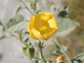
Abutilon coahuilae
|
Photographer: E. Wynn Anderson
ID: 0000 0000 0814 3000 (2014-08-27)Copyright © 2014 Wynn Anderson
|
|
INFORMATION PROVIDED WITH THE PHOTO
|
date of photo Jul 11, 2013
latitude 25.57910 longitude 102.72070
View on Google Maps.
location
kM 189, MX hiway 40 east (libre), 10.8 miles east of merge with MX 40 west, Sierra Parras, (Mcpio. Parras, Coahuila, Mexico)family
Malvaceae
plant community Chihuahuan Desert scrub, (Agave, Opuntia, Jatropha) at 1086 m (3650')notes along abandoned section of old road pavement at base of limestone hillside at southern end of the Sierra Parras with Annulocaulis eriosolenus, Sericodes greggii, Talinopsis frutescens, Sengalia crassifoliakeywords: CDR, Chihuahuan Desert
contributor's ID # CDR 88 photo category: Plant - shrub
|
MORE INFORMATION ABOUT THIS PLANT
|
| View all photos in CalPhotos of Abutilon coahuilae Check Google Images for Abutilon coahuilae |
|
The photographer's identification Abutilon coahuilae has not been reviewed. Sign in to review or comment on this photo |
|
Using this photo The thumbnail photo (128x192 pixels) on this page may be freely used for personal or academic purposes without prior permission under the Fair Use provisions of US copyright law as long as the photo is clearly credited with © 2014 Wynn Anderson.
For other uses, or if you have questions, contact E. Wynn Anderson wanderson@UTEP.edu. |
|
|
